How to Find Out If Land Is Green Belt
Three ways to check whether a property or piece of land is in the green belt, and what the designation means for development and planning permission.
Green belt is one of the most restrictive planning designations in England. If you're looking at buying land, considering an extension, or investigating development potential, you need to know whether the green belt applies. Here's how to check.
Method 1: Use our free planning constraints tool
The Planning Constraints Map shows green belt boundaries across England, sourced from planning.data.gov.uk.
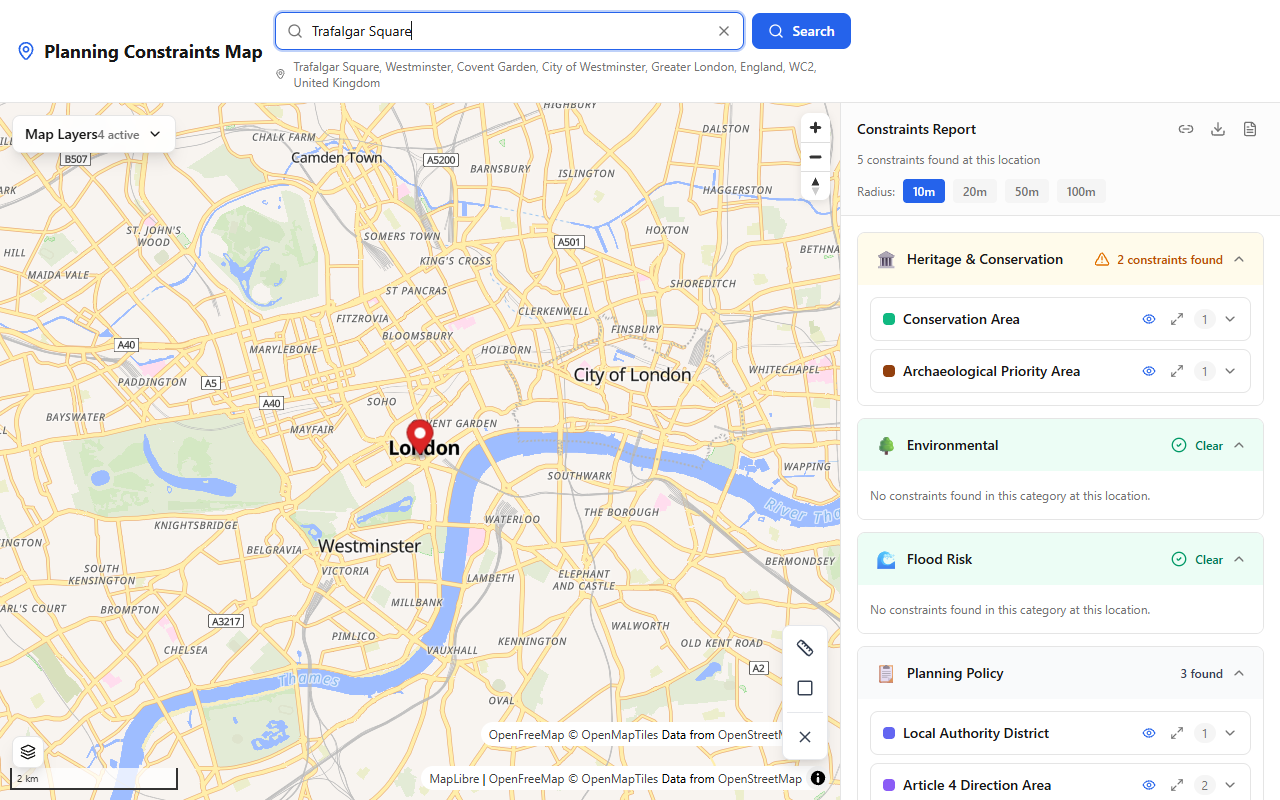
The Planning Constraints Map shows all constraint categories including green belt status for any searched location.
- Open the Planning Constraints Map
- Search for the postcode, address, or coordinates
- Check the results panel for green belt entries
- Green belt land is shaded on the map so you can see the exact boundary
You'll also see every other constraint that applies — flood zones, conservation areas, listed buildings, and more — giving you the full picture in one search.
Method 2: Check the Local Plan policies map
Every council publishes a Policies Map (sometimes called a Proposals Map) as part of its Local Plan. This shows green belt boundaries along with all other planning designations. Search for "[your council name] policies map" or "[your council name] Local Plan map."
The advantage of checking the council's own map is that it's the definitive version used to make planning decisions, and it may also show any areas where the council has proposed changes to green belt boundaries in a draft or emerging Local Plan.
Method 3: Local Authority Search
The standard Local Authority Search (CON29) carried out during conveyancing will confirm whether a property is in the green belt. This is part of the routine property purchase process handled by your solicitor.
What does green belt mean for your property?
Green belt is a planning policy tool designed to prevent urban sprawl. It doesn't mean the land is beautiful or environmentally valuable — it simply means development is heavily restricted to keep the land open.
The general rule
New development in the green belt is considered "inappropriate" unless it falls within a specific list of exceptions. Inappropriate development should only be approved in "very special circumstances" — a high bar that is rarely met for ordinary proposals.
What you can do
Several types of development are not inappropriate in the green belt:
- Extensions — provided they're not disproportionate compared to the original building. What counts as disproportionate varies between councils, but a common threshold is around a 30–50% increase in floor area.
- Replacement buildings — provided the new building is in the same use and not materially larger than the one it replaces.
- Agricultural buildings — farm buildings and structures needed for farming or forestry.
- Outdoor sport and recreation facilities — as long as they preserve the openness of the green belt.
- Brownfield redevelopment — partial or complete redevelopment of previously developed land, provided it doesn't have a greater impact on openness.
What you generally can't do
- Build a new house on undeveloped green belt land (unless you can demonstrate very special circumstances)
- Significantly enlarge an existing property beyond what's considered proportionate
- Develop in a way that materially reduces the openness of the green belt
Extensions specifically
Homeowners can extend their properties in the green belt, but there's a "disproportionate additions" test. If the cumulative size of all extensions (including any that previous owners added) exceeds what the council considers proportionate relative to the original building, the application will likely be refused.
Check your council's planning policies for specific guidance — some councils publish supplementary documents setting out their approach to green belt extensions.
Can green belt boundaries change?
Yes, but only through the Local Plan process. Councils can review green belt boundaries if they demonstrate "exceptional circumstances" — typically when they've exhausted all other options for meeting housing need within existing urban areas.
Green belt reviews have become more common in recent years as housing demand has grown. If land is removed from the green belt through a Local Plan review, it's usually allocated for housing or mixed-use development.
If you're looking at land near the edge of the green belt, it's worth checking whether the council's emerging Local Plan proposes any changes to the boundary.
Summary
Three ways to check whether land is in the green belt:
- Quickest — Use the Planning Constraints Map for instant results from official data
- Most detail — Check your council's Local Plan policies map
- During purchase — The Local Authority Search confirms green belt status
Green belt is a strong constraint but not an absolute ban. Extensions, replacements, and agricultural buildings can be acceptable — the key question is always whether the proposal preserves the openness of the green belt.
Survey your own site — free
See every planning constraint at any UK address in seconds: conservation areas, listed buildings, flood zones, Article 4 and 30+ more. Need it on paper? The Full Survey Report with plain-English guidance is £9.99.