Check a site’s planning constraints.Keep a clear record.
Search an address for recorded heritage, flood and planning designations. Explore the map free, or get a source-linked PDF report for £9.99.
Postcode, address, grid reference or UPRN. England, Wales and Scotland, free, no signup.
3 free checks a day · No signup required
Coverage varies by location and dataset. A missing result does not confirm a site is clear. Confirm material findings with the relevant authority.
Official open data · planning.data.gov.uk · Historic England · Natural England · Environment Agency · HM Land Registry · Cadw · Historic Environment Scotland · NatureScot
How it works
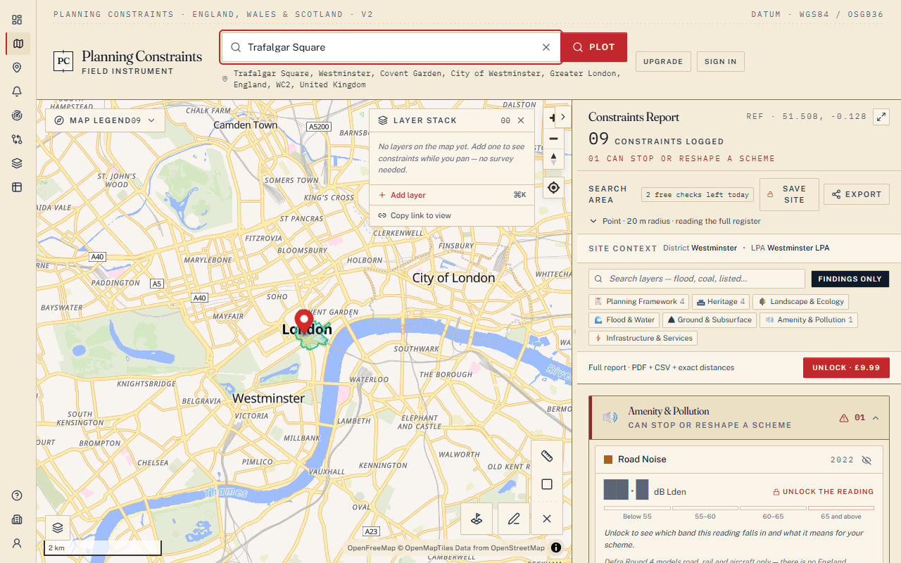
Plot a point
Enter a postcode, address, UPRN, grid reference — or click the map to drop a pin.
Survey constraints
Review recorded constraints, check the coverage and follow the source links for findings that matter to your site.
Read the file
Inspect boundaries on the map and expand each finding free — then order the Full Survey Report for the PDF, CSV export and plain-English guidance.
What we check
133 datasets in our register across England, Wales and Scotland. Sources and availability differ by nation, location and plan. A sample:
Official sources only
Every finding is traceable to its official source. Most of our data is published under the Open Government Licence; every source and its licence is listed on our Licences page.
Planning Data (MHCLG)
Conservation areas, green belt, TPOs, Article 4 and more (England)
Historic England
Listed buildings, scheduled monuments, registered parks (England)
Natural England
SSSIs, ancient woodland, national landscapes (England)
Environment Agency
Flood zones 2 and 3 (England)
Cadw & Natural Resources Wales
Listed buildings, conservation areas, TAN15 flood mapping (Wales)
Historic Environment Scotland & NatureScot
Listed buildings, scheduled monuments, SSSIs and more (Scotland)
From the journal
7 Free Open Data Sources to Check Planning Constraints in England
A guide to the best free government open data sources for checking planning constraints on any site in England — and how to search them all at once.
6 Government Websites Every Property Developer Should Bookmark
The essential free government data websites for checking planning constraints, environmental designations, flood risk, and heritage status on development sites in England.
10 Things Open Planning Data Can Tell You Before You Buy a Property
What free government open data can reveal about a property before you make an offer — from flood risk and heritage designations to green belt and ecological constraints.
Check your next site
Search a postcode or click on the map to review recorded constraints. Keep a source-linked report when you need a record for your property or project file.