Everything you need to checkplanning constraints
One search. Every constraint. Backed by official government data.

Key features
Built for speed, accuracy, and ease of use — everything you need in one free tool.
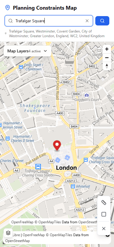
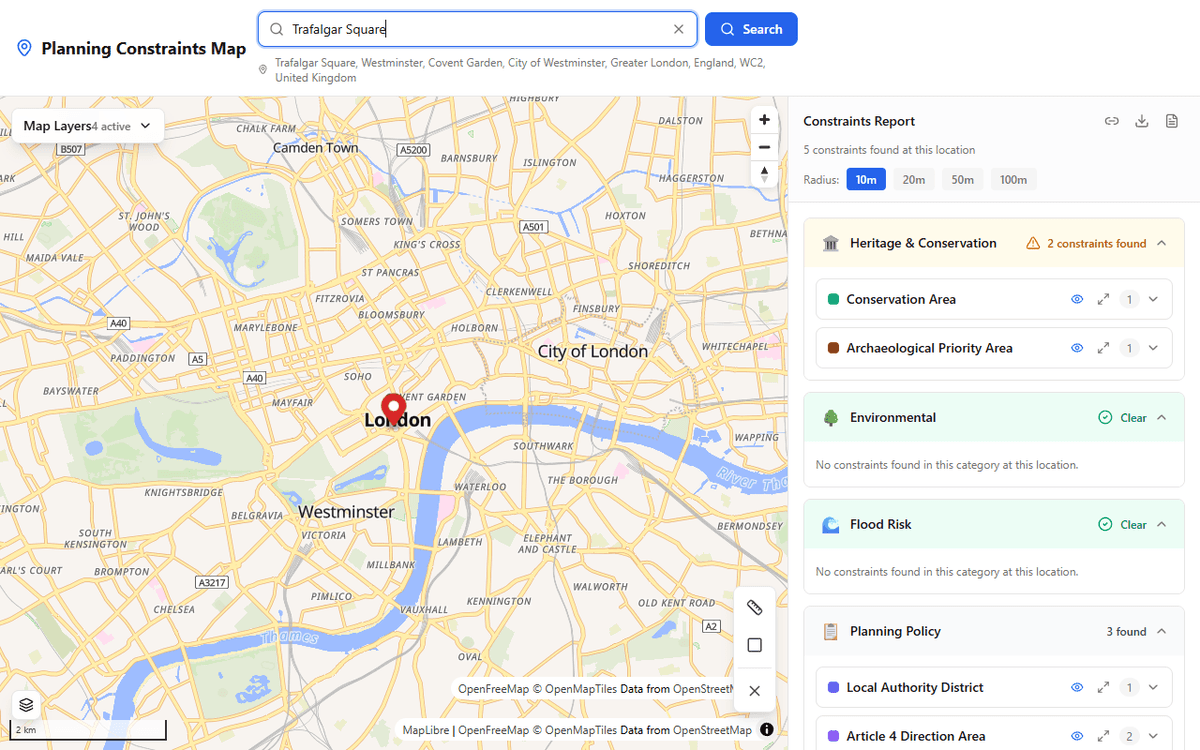
Instant Results
Search any postcode or address and see all planning constraints within seconds. No waiting, no signup required.
30+ Constraint Types
Conservation areas, listed buildings, flood zones, green belt, TPOs, SSSIs, Article 4 directions, and more — all in one search.
Official Data Sources
Every result comes from authoritative government APIs: planning.data.gov.uk, Historic England, Natural England, and the Environment Agency.
Interactive Map
Constraint boundaries drawn directly on the map so you can see exactly where designations start and end.
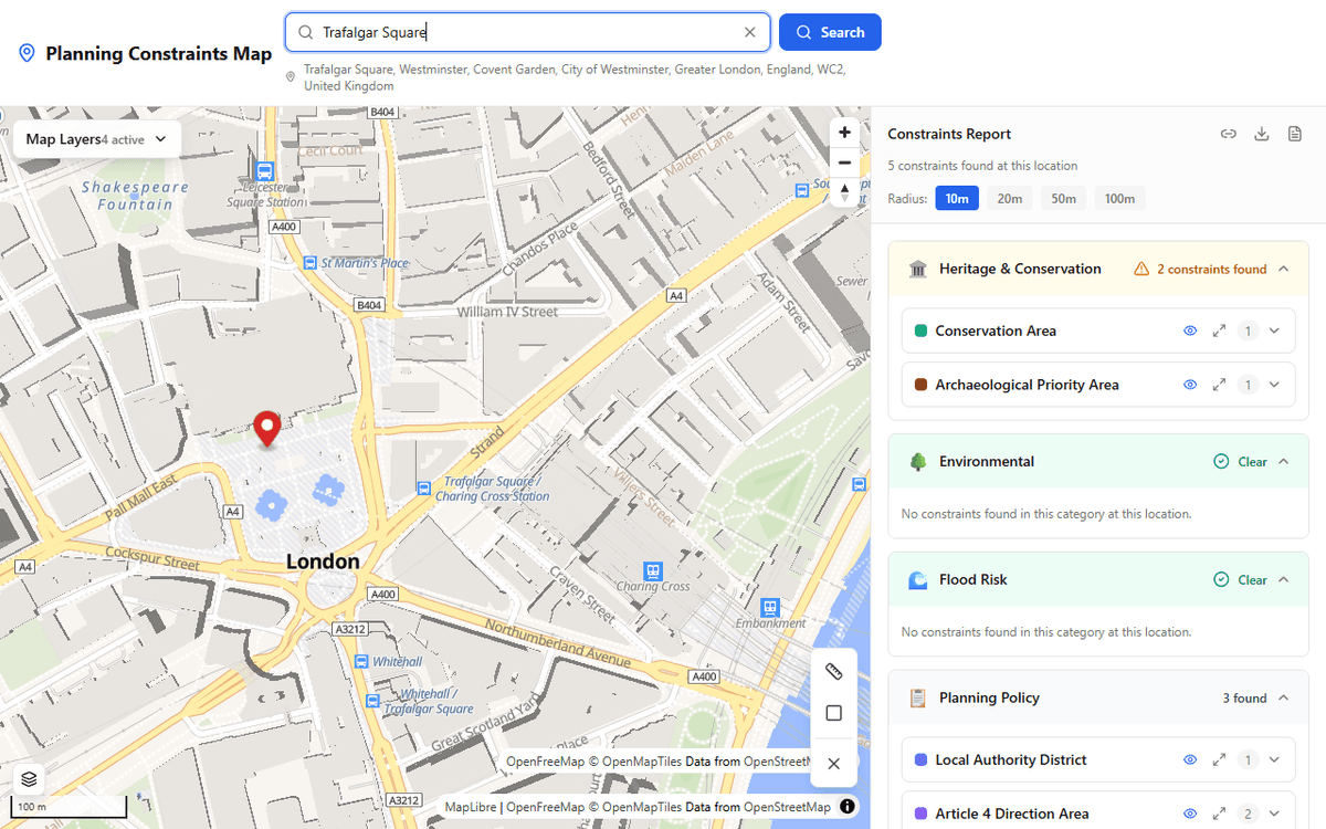
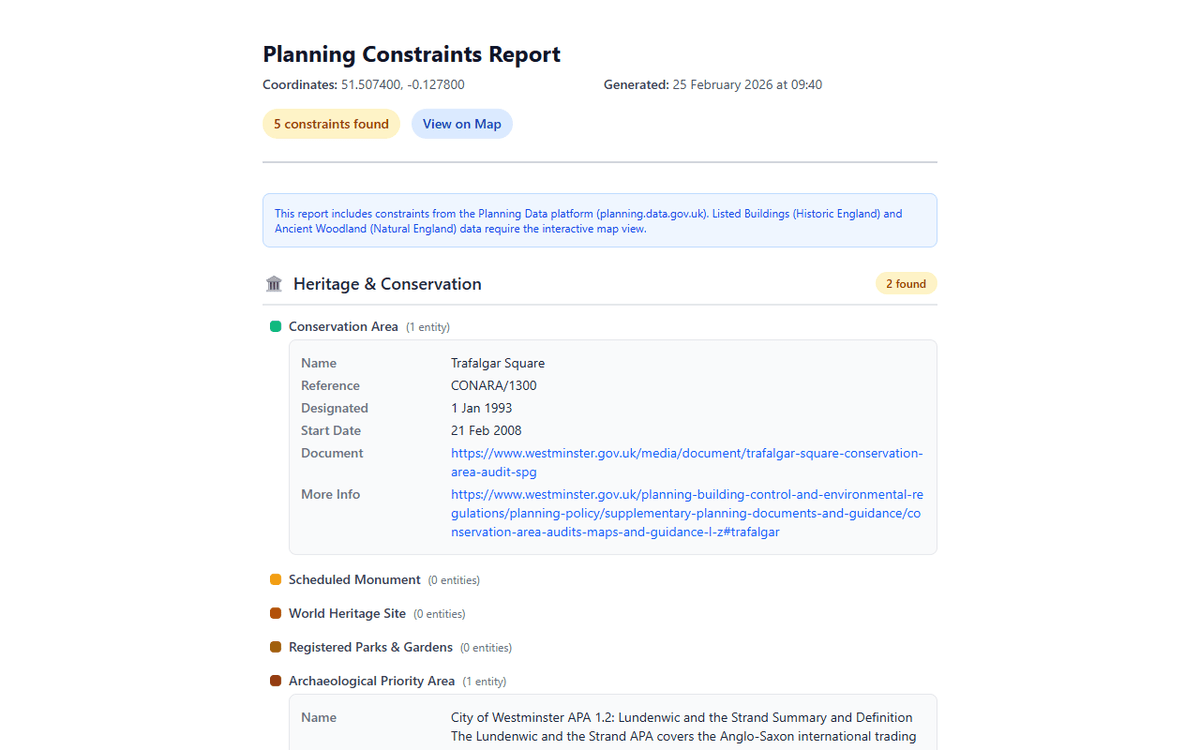
Detailed Reports
Generate and download planning constraints reports with full details from every data source.
Mobile Friendly
Works beautifully on phones and tablets with a responsive bottom sheet for constraint results.
How it works
Three simple steps to a full planning constraints check.
Search
Enter a postcode, address, or click anywhere on the map to start your search.

View constraints
See every planning constraint for your location, pulled from official government APIs in seconds.
Explore detail
Dive into individual constraints, view boundaries on the map, and generate a full PDF report.
What we check
Over 30 constraint datasets from official government sources. Here are the key designations we cover.
Conservation Areas
Protected areas of architectural or historic interest
Listed Buildings
Grade I, II*, and II structures of special interest
Flood Zones 2 & 3
Areas at risk of river and sea flooding
Green Belt
Land protected from urban sprawl
AONB / National Landscapes
Areas of outstanding natural beauty
Ancient Woodland
Irreplaceable natural habitats
SSSIs
Sites of Special Scientific Interest
Tree Preservation Orders
Individually protected trees and woodland
Scheduled Monuments
Nationally important archaeological sites
National Parks
Protected landscapes and ecosystems
Special Areas of Conservation
European-level nature designations
Article 4 Directions
Areas with restricted permitted development
Coal Mining Risk Areas
Development high risk areas for coal mining
Trusted data sources
All data comes from authoritative UK government APIs, licensed under the Open Government Licence. No scraping, no guesswork.
The Ministry of Housing, Communities and Local Government provides data on conservation areas, green belt, tree preservation orders, Article 4 directions, and many more local planning designations.
The public body that looks after England's historic environment. Provides data on listed buildings, scheduled monuments, registered parks and gardens, and World Heritage Sites.
The government's adviser for the natural environment in England. Provides data on SSSIs, ancient woodland, national landscapes (AONBs), and other ecological designations.
Responsible for flood risk management in England. Provides detailed flood zone mapping including Flood Zone 2 (medium probability) and Flood Zone 3 (high probability).
Now the Mining Remediation Authority. Provides data on development high risk areas where coal mining may affect ground stability and planning requirements.
Who uses Planning Constraints?
Whether you are buying a home, designing a project, or conducting due diligence, our tool saves you time and money.
Homebuyers
Check constraints before making an offer to avoid costly surprises
Architects & Planners
Quickly scope site constraints at the start of any project
Property Developers
Screen sites for development potential and constraint risks
Solicitors & Conveyancers
Speed up due diligence with instant constraint data
Ready to check your site?
Search any postcode or click on the map to get a full planning constraints report in seconds.