5 Planning Constraints You Can Check Online for Free Right Now
The five most common planning constraints that affect property in England and how to check each one using free open data tools — no sign-up required.
The fastest way to check all of these at once: go to PlanningConstraints.com, enter a postcode, and get instant results from official government data. Free, no sign-up.
Whether you are buying a house, planning an extension, or scoping out a development site, there are five planning constraints that come up more than any others. All of them can be checked online for free using government open data.
Here they are, why each one matters, and exactly how to check.
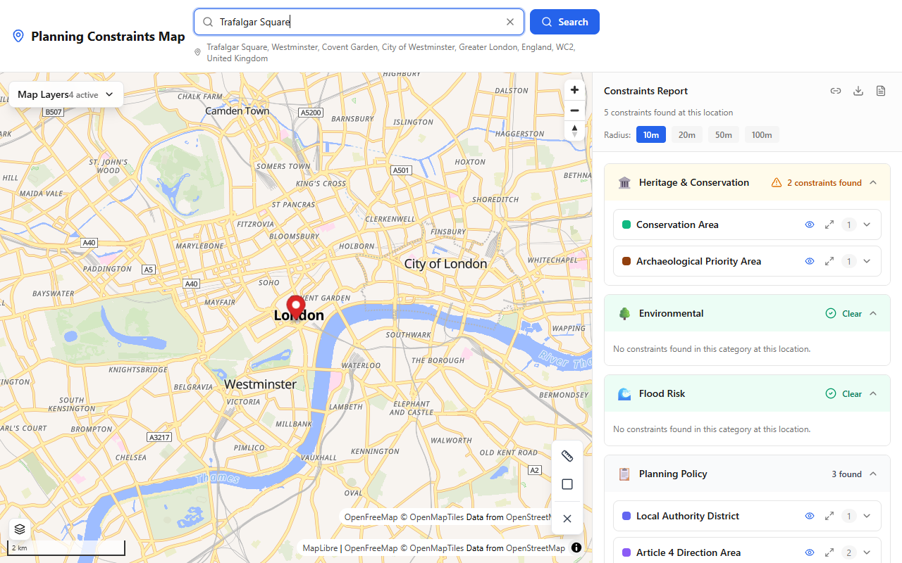
PlanningConstraints.com showing Conservation Area and Archaeological Priority Area results for a central London location.
1. Conservation areas
Why it matters: In a conservation area, permitted development rights are reduced. You will likely need planning permission for work that would normally be allowed elsewhere — including demolition, cladding, satellite dishes, and some extensions. Design standards are higher and the council can refuse applications that harm the character of the area.
How to check for free:
- Fastest: Search your address on PlanningConstraints.com — conservation areas are shown instantly under Heritage & Conservation
- Direct source: Search planning.data.gov.uk for conservation area datasets published by local authorities
- Council website: Check your council's interactive policies map
Conservation area data comes from local planning authorities and is published nationally through the Planning Data platform.
2. Flood zones
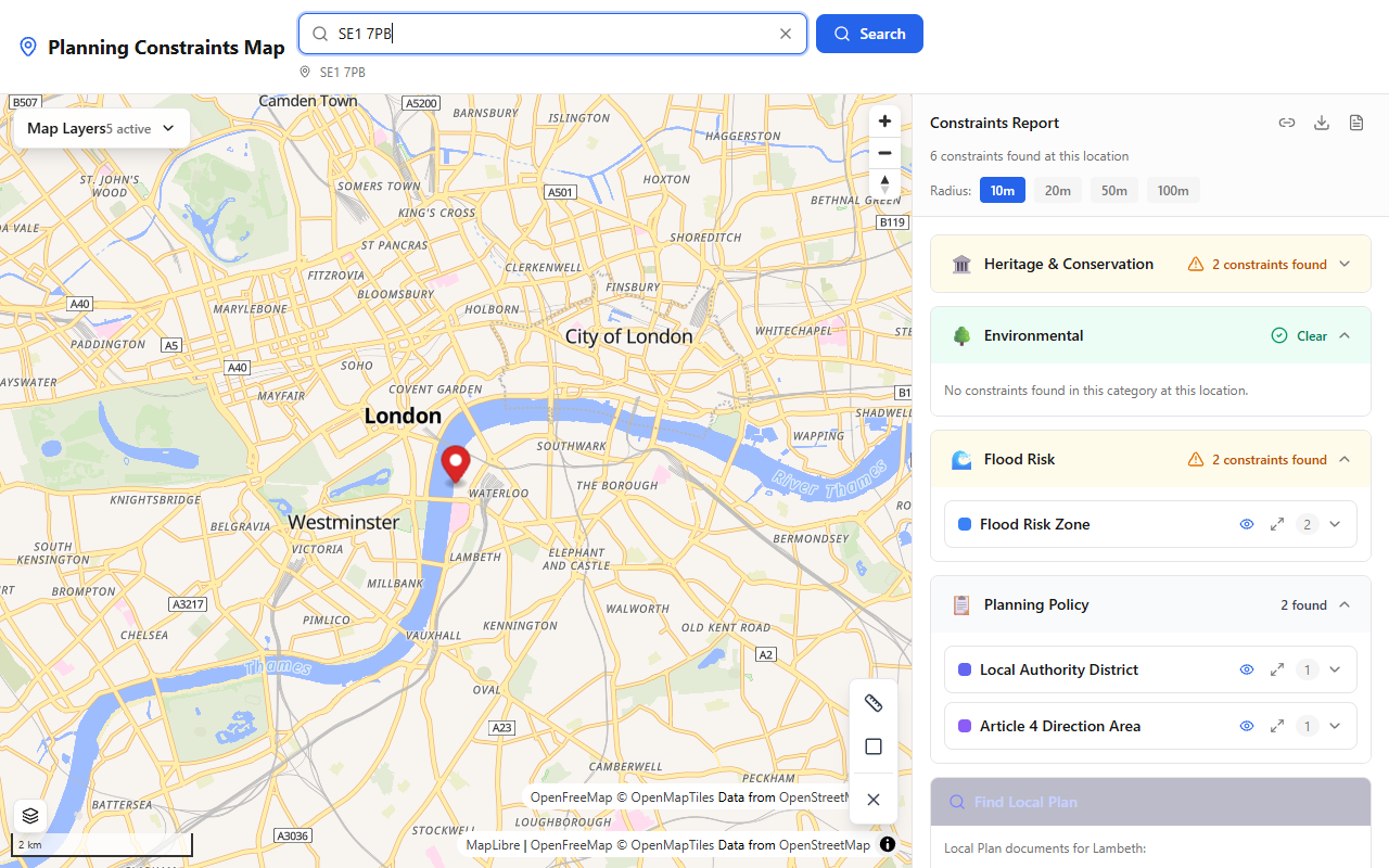
Flood Risk Zone results near the Thames on PlanningConstraints.com — checked automatically from Environment Agency data.
Why it matters: If a site is in Flood Zone 2 or 3, you will need a site-specific flood risk assessment for most types of development. You may also need to demonstrate through the Sequential Test that there is no suitable alternative site at lower flood risk. Insurance costs can be significantly higher.
How to check for free:
- Fastest: PlanningConstraints.com checks Environment Agency flood zone data automatically and shows results under Flood Risk
- Direct source: Use the Environment Agency's Flood Map for Planning to see Flood Zone 2 and 3 boundaries
- Long-term risk: Check the government's Check your long term flood risk service for surface water and reservoir flooding
Flood zone boundaries are updated regularly by the Environment Agency using the latest modelling data.
3. Listed buildings
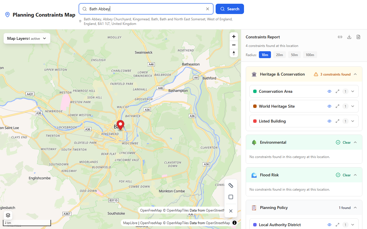
PlanningConstraints.com showing World Heritage Site and Listed Building results in Bath — pulled from Historic England data.
Why it matters: Altering a listed building — internally or externally — without listed building consent is a criminal offence. Even minor works like replacing windows, adding a porch, or re-pointing brickwork can require consent. The listing applies to the entire building and any structures within its curtilage.
How to check for free:
- Fastest: PlanningConstraints.com checks Historic England data and flags any listed buildings at or near your location
- Direct source: Search the National Heritage List for England by address or map location
- Detail: Each list entry includes the grade (I, II*, or II), a description of the building, and the date of listing
There are approximately 400,000 listed buildings in England. Around 92% are Grade II.
4. Green belt
Why it matters: The green belt is one of the most restrictive planning constraints. There is a strong presumption against new development on green belt land unless very special circumstances can be demonstrated. Extensions, replacement buildings, and changes of use may be acceptable if they meet strict criteria, but new houses are almost never permitted.
How to check for free:
- Fastest: PlanningConstraints.com shows green belt boundaries under Planning Policy
- Direct source: Search planning.data.gov.uk for green belt datasets
- Council map: Green belt boundaries are defined in Local Plans and shown on councils' policies maps
Around 13% of land in England is designated as green belt, mostly around major cities and towns.
5. Tree preservation orders (TPOs)
Why it matters: A TPO makes it an offence to cut down, top, lop, uproot, damage, or destroy a protected tree without the council's written consent. This applies even if the tree is on your own land. Fines for breaching a TPO can be unlimited.
How to check for free:
- Fastest: PlanningConstraints.com checks TPO data from planning.data.gov.uk
- Direct source: Search planning.data.gov.uk for tree preservation order datasets
- Council records: Contact your local council's tree officer if you need specific details about a TPO
TPO coverage in the national dataset is improving as more councils digitise and publish their records, but some councils still maintain these records only on paper.
Check all five in one search
Instead of visiting five different websites, you can check all of these constraints in a single search on PlanningConstraints.com. Enter a postcode or click anywhere on the map and the tool queries official government APIs in real time.
Results are grouped by category — Heritage & Conservation, Environmental, Flood Risk, and Planning Policy — so you can see at a glance what applies to your site.
Survey your own site — free
See every planning constraint at any UK address in seconds: conservation areas, listed buildings, flood zones, Article 4 and 30+ more. Need it on paper? The Full Survey Report with plain-English guidance is £9.99.